A low pressure area west of the Alps creates a hairdryer-like southerly flow. There is a Fohn storm on the mountaintops, with wind speeds reaching more than 100 kilometers per hour during the night until Sunday. This, combined with moist air masses and a cold front, causes a lot of snow in the Southern Alps and a high risk of avalanches. After the weekend, the weather will remain changeable, but in the second half of the week the influence of the high pressure area will increase. This will ensure calmer weather with less wind and more room for the sun.
Weather forecast in brief:
- Storm Föhn will reach its peak overnight into Sunday, with wind gusts exceeding 100 kilometers per hour.
- On the southern side of the Alps, between 50 and 100 cm of fresh snow is expected to fall and the risk of avalanches is increasing!
- Saharan dust in the air on Sunday, especially over Austria
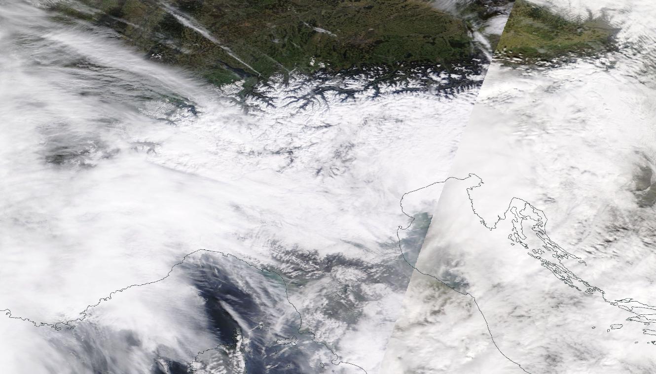

The difference between the Southern Alps (Stau) and the Northern Alps (Föhn) was clear on Saturday. Source: NASA World View
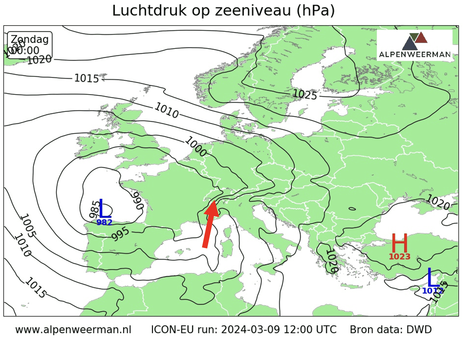

The southerly current will cause a Föhn storm in the Alps overnight from Saturday to Sunday. The highest wind speed is reached in the Western Alps.
Highlight the Föhnstorm at night through Sunday
The Föhnstorm peaks from Saturday afternoon to Sunday morning. Wind speeds are expected to range from 100 to 130 kilometers per hour, reaching high speeds in the Western Alps. High wind speeds may also cause lift restrictions at ski areas this weekend.
This video was filmed on Saturday and shows the Föhnmuur clearly on the south side. Source: srfmeteo via X
Lots of new snow and rain on the southern side of the Alps
This weekend, there will be a lot of snow again in the south and southwest of the Alps. About 50 to 100 cm of fresh snow falls here from an altitude of about 1,100 to 1,300 metres. Locally, the snowfall line can drop below 1,000 metres. In the lower regions, frequent rains and floods must be taken into account. With strong Vohn winds, the risk of avalanches will increase significantly this weekend!
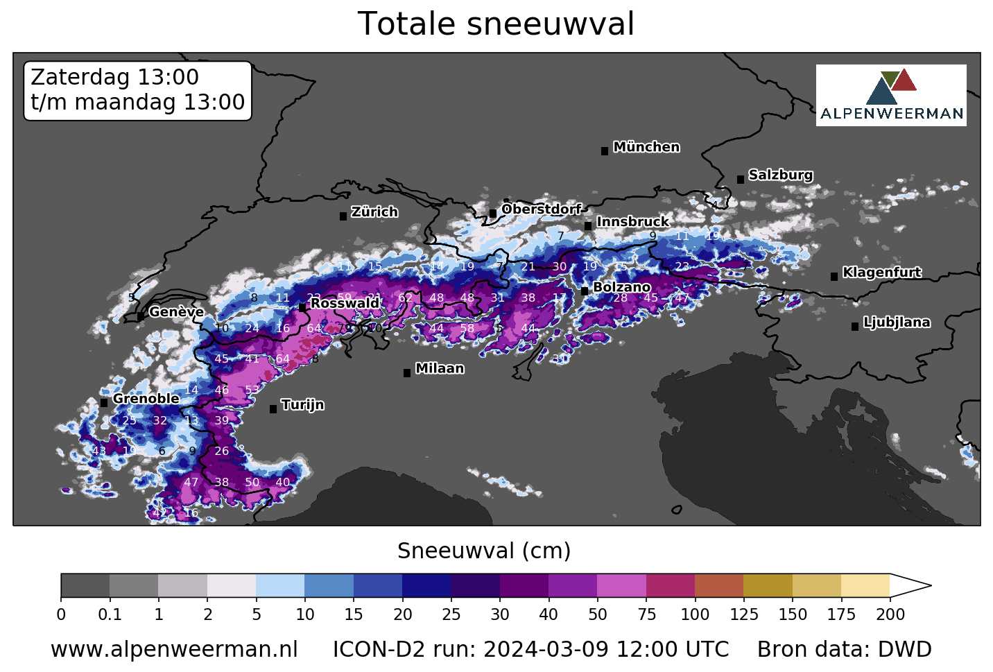

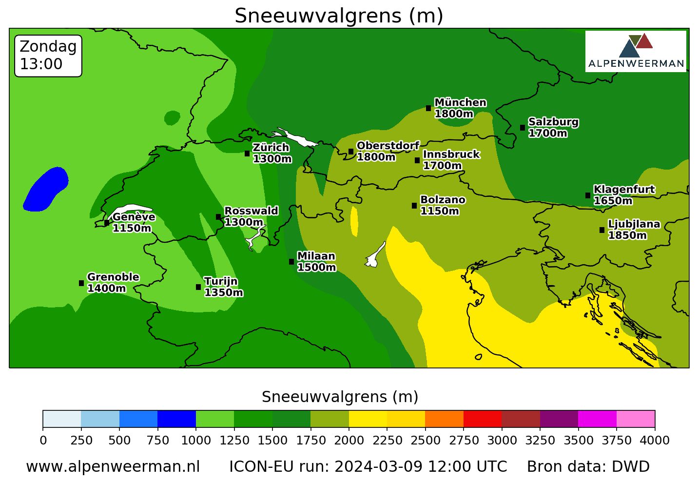

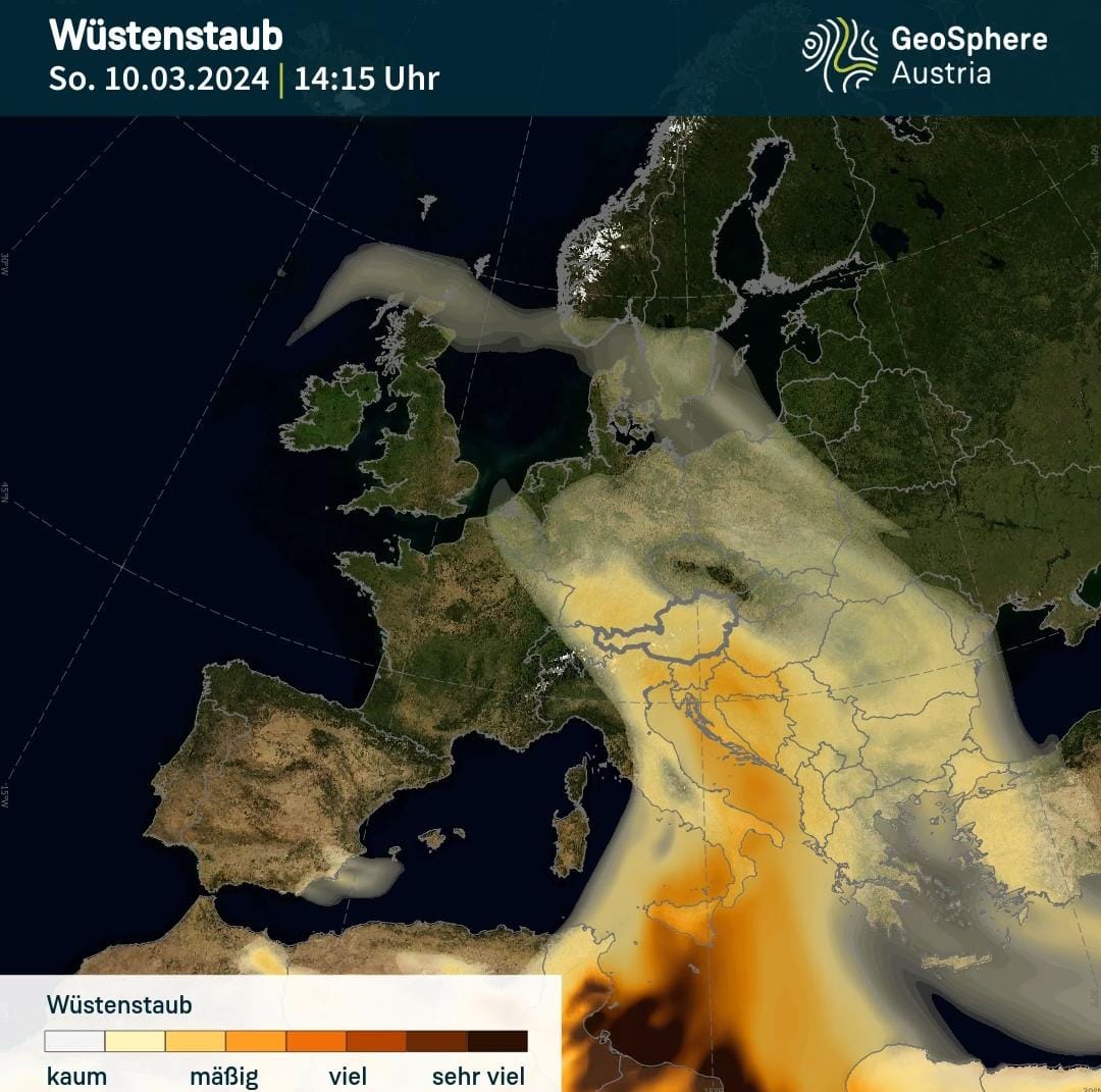

On Sunday, there will also be some Saharan dust in the atmosphere, which will mainly affect the Eastern Alps. Source: GeoSphere Austria, via Facebook
The strength of the Föhn winds will gradually decrease during Sunday. A strong southerly current also brings part of the desert dust. Concentration will be high on Sunday, especially in Austria. Furthermore, the weather will remain mainly dry on the northern side of the Alps, but the amount of sunlight will be limited due to dust.
Variable in the Western Alps on Monday, more sun in the Eastern Alps
In the west of the Alps, clouds are abundant, especially in the morning. In the Eastern Alps, on the other hand, there is more room for the sun and to remain dry. Temperatures continue to rise, with temperatures in the valley reaching more than 10 degrees, and the frost line reaching about 2,000 metres. The winds will also calm somewhat after the turbulent weekend and the amount of rain will also decrease.
Outlook: Variable and increasing impact of high pressure
Tuesday will be volatile with heavy clouds on the northern side of the Alps, where some snow may fall again. The snowfall limit is very low, less than 1000 metres. To the east of the Alps it remains dry and often sunny. There is a strong chance of Hochnibel in the valleys.
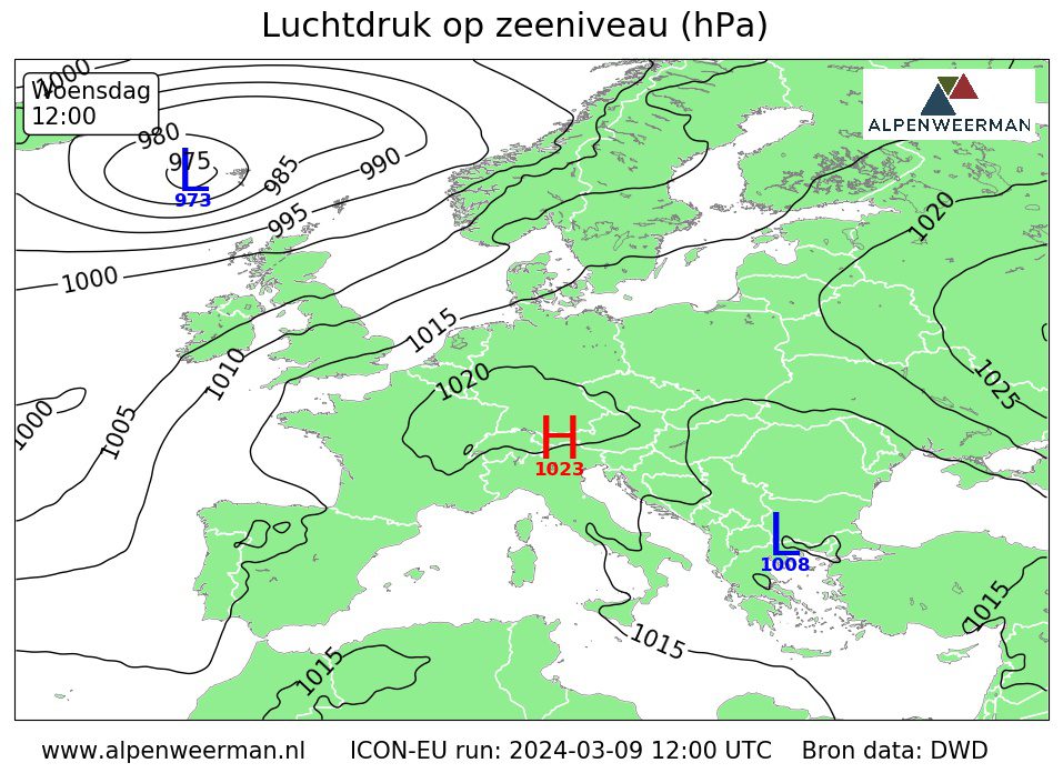

On Wednesday, the high pressure area will be centered over the Alps. This will ensure calmer weather and less wind in the Alps.
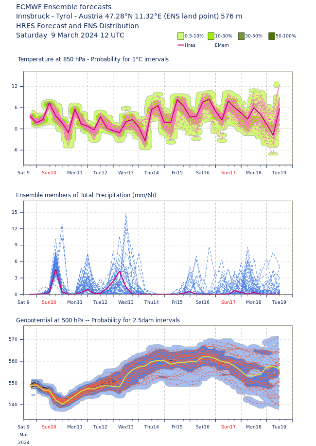

Obviously, the chance of rain decreases in the second half of the week. The air pressure gradually rises, which means the fluctuations will decrease. (Source: ECMWF, Metrogram sample point: Innsbruck)
Wednesday will be a mix of fog, sun and clouds. During the day there can be showers everywhere and winds are present. There will be a slight rise in temperatures, and the chances of rain will continue to decrease after Wednesday. With rising temperatures and strong daily flow, the weather is starting to look like spring in the Alps.
(Visited 3,333 times, 232 visits today)
Roy graduated from Wageningen University. As a BA he completed the Soil, Water and Atmosphere course. During his master's degree he also specialized in hydrology and meteorology. Furthermore, he has also taken several courses in Norway and conducted research in Spitsbergen. Roy writes Alpine weather reports for Alpenweerman, gives lectures on the weather and provides ski reviews at ski areas.

“Lifelong food practitioner. Zombie geek. Explorer. Reader. Subtly charming gamer. Entrepreneur. Devoted analyst.”


More Stories
Revealing the ten countries that support Ukraine the most
Funny protest against mass tourism in Galician village
Kamala Harris has wind in her sails, but Trump can still win